 GyanGram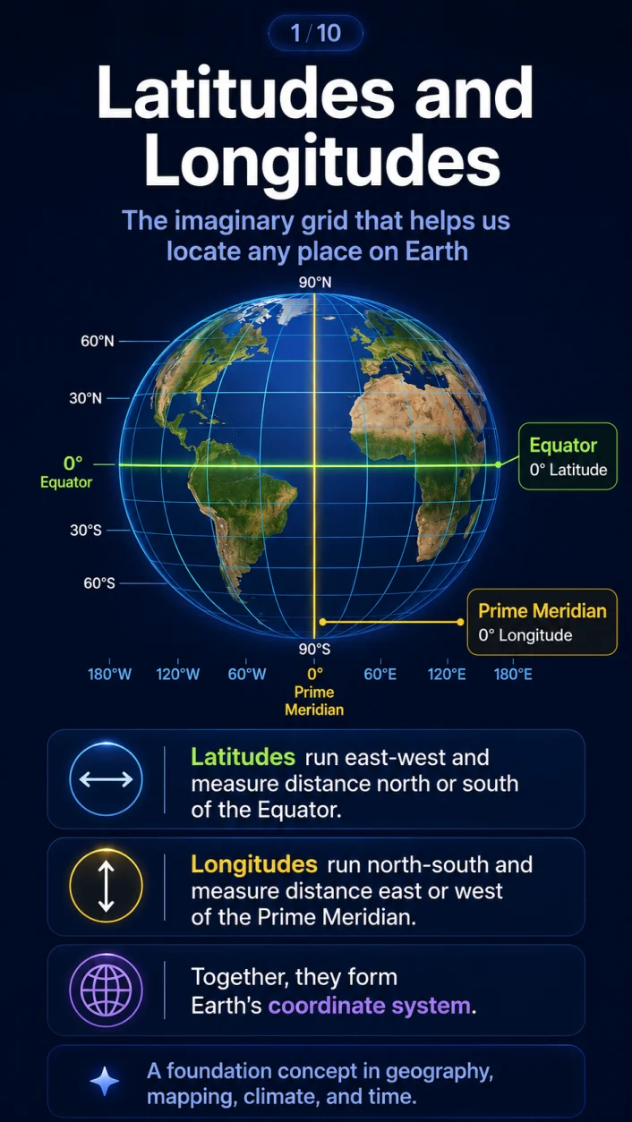
Latitude and Longitude
The geographic grid that locates every place on Earth
Latitude tells us how far north or south a place lies from the Equator. Longitude tells us how far east or west it lies from the Prime Meridian.
Why do we need a geographic grid?
Earth is approximately spherical. Unlike a flat sheet of paper, it has no natural starting point, edge or corner from which locations can be measured.
Geographers therefore created an imaginary network of lines over the globe. This network is called the geographic grid or graticule.
- Parallels of latitude show north–south position.
- Meridians of longitude show east–west position.
What is latitude?
Latitude is the angular distance of a place north or south of the Equator, measured from the centre of Earth.
Parallels of latitude
Lines joining all places with the same latitude are called parallels. They run east–west, never meet, and become smaller towards the poles.
What is longitude?
Longitude is the angular distance of a place east or west of the Prime Meridian. Meridians meet at both poles and are widest apart at the Equator.
Longitude explains local time: Earth rotates 15° in about one hour, so 1° of longitude corresponds to four minutes.
Quick revision
Latitude and longitude connect Earth’s shape, climate, navigation and timekeeping into one coordinate system.